Drone Mapping Services
RGB Aerial Mapping, 2D Orthomosaics, Nadir Mapping, Oblique Imagery, Facade Capture & 3D Visual Site Models
Tex-Air Drone provides professional photogrammetry drone mapping services for oil and gas sites, pipeline corridors, utility rights-of-way, critical infrastructure, commercial construction, industrial facilities, solar sites, transportation corridors, and large project sites across Texas, New Mexico, and Oklahoma.
Our mapping services are built for project owners, engineers, surveyors, contractors, utility providers, asset managers, construction teams, and infrastructure operators who need current visual documentation, measurable site maps, and repeatable project records.
Using RGB aerial imagery, nadir mapping, oblique capture, facade mapping, and photogrammetry processing, Tex-Air Drone turns complex jobsite conditions into usable visual deliverables such as 2D orthomosaic maps, 3D photogrammetry models, textured meshes, facade image sets, construction progress maps, site documentation packages, and cloud-based project links.
Tex-Air Drone is not a licensed surveying company and does not replace surveyors or engineers. We support licensed professionals by providing high-quality aerial imagery and photogrammetry-based mapping data that helps reduce field time, improve project visibility, document site conditions, and make infrastructure projects easier to manage.
Industrial Photogrammetry Mapping for Real-World Site Documentation
Photogrammetry drone mapping uses overlapping aerial images to create accurate visual records of sites, structures, corridors, and assets. Unlike basic drone photography, photogrammetry is captured with planned flight patterns and processed into organized deliverables that can be reviewed, measured, compared, and shared.
Tex-Air Drone provides photogrammetry mapping data for:
Oil and gas site documentation
Pipeline corridor mapping
Pipeline right-of-way documentation
Utility corridor mapping
Substation visual documentation
Critical infrastructure mapping
Commercial construction mapping
Construction progress documentation
Industrial site mapping
Solar site documentation
Transportation corridor imagery
2D orthomosaic maps
Nadir aerial mapping
Oblique drone imagery
Facade mapping
3D photogrammetry models
Textured visual models
Digital site records
Cloud-based project documentation
Whether the project involves a pipeline route, well pad, tank battery, compressor station, substation, solar site, industrial facility, commercial construction site, roadway corridor, utility right-of-way, or critical infrastructure asset, Tex-Air Drone captures the RGB imagery needed to see the site clearly and document conditions accurately.
Our Services
-
2D Orthomosaic Drone Mapping
-
Nadir Mapping for Top-Down Site Documentation
-
Oblique Drone Mapping for 3D Perspective and Site Context
-
Facade Mapping for Vertical Asset Documentation
-
3D Photogrammetry Models and Textured Meshes
-
RGB Drone Mapping for Oil and Gas Sites
-
Pipeline Corridor and Right-of-Way Photogrammetry
-
Utility and Critical Infrastructure Drone Mapping
-
Construction Progress Mapping for Infrastructure Projects
-
Solar Site Photogrammetry Mapping
2D Orthomosaic Drone Mapping
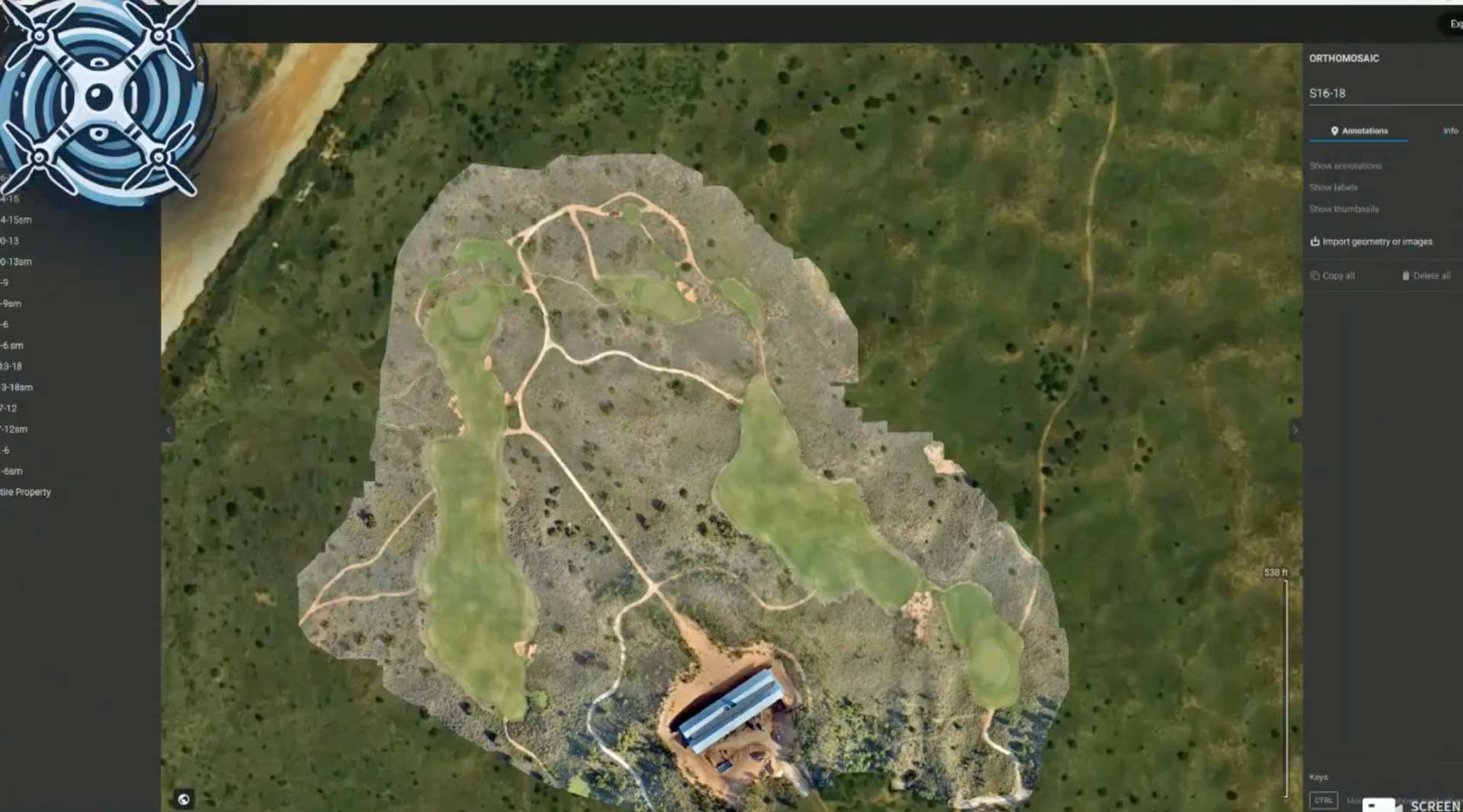
A 2D orthomosaic is a high-resolution aerial map created by stitching many overlapping drone images into one continuous, corrected map. This gives project teams a current top-down view of the site that is far more detailed than most satellite imagery.
See details
2D orthomosaic drone mapping is useful for:
- Pipeline corridor maps
- Oil and gas lease site maps
- Well pad documentation
- Tank battery site records
- Compressor station mapping
- Utility right-of-way documentation
- Substation site mapping
- Construction progress maps
- Commercial site development
- Industrial yard mapping
- Solar site documentation
- Access road records
- Site logistics planning
- Material staging documentation
- Storm damage documentation
- Drainage and erosion visual review
- As-built visual records
For infrastructure projects, a current orthomosaic map gives owners, contractors, engineers, surveyors, and field teams a shared visual reference. This helps reduce confusion, improve project communication, and preserve a dated record of site conditions.
Solar Site Photogrammetry Mapping
Solar facilities benefit from current aerial imagery, repeatable site records, construction progress maps, and visual asset documentation. Tex-Air Drone provides RGB photogrammetry mapping for solar construction sites and operating solar facilities.
See details
Solar site mapping can support:
- Solar construction progress maps
- Site layout documentation
- Access road records
- Panel row visual documentation
- Vegetation condition imagery
- Storm damage documentation
- Asset management records
- 2D orthomosaic maps
- 3D visual site models
- Cloud-based documentation
Thermal inspection services can be addressed on Tex-Air Drone’s separate thermal inspection page. This mapping page should remain focused on RGB photogrammetry, 2D orthomosaics, 3D visual models, nadir imagery, oblique imagery, and facade capture.
Nadir Mapping for Top-Down Site Documentation
Nadir mapping captures imagery straight down from above the site. This is the foundation of 2D orthomosaic mapping and is one of the most useful capture methods for large sites, linear corridors, and construction projects.
See details
Nadir drone mapping can support:
- Top-down site maps
- Corridor documentation
- Pipeline route imagery
- Utility right-of-way imagery
- Construction site documentation
- Industrial facility layout maps
- Solar site layout maps
- Roadway and access route documentation
- Equipment and material staging records
- Laydown yard mapping
- Site access planning
- Progress comparison over time
Nadir mapping is especially useful when teams need to understand the full layout of a project. Instead of relying on scattered field photos, project managers can review the entire site in one organized visual map.
Oblique Drone Mapping for 3D Perspective and Site Context
Oblique mapping captures angled imagery that shows the sides of structures, equipment, terrain changes, buildings, tanks, pipe racks, and vertical assets. This gives project teams a better understanding of site context than top-down imagery alone.
See details
Oblique drone mapping is useful for:
- 3D photogrammetry models
- Textured visual site models
- Industrial structure documentation
- Oil and gas facility documentation
- Tank battery imagery
- Compressor station documentation
- Substation structure imagery
- Commercial building documentation
- Construction progress visualization
- Site logistics review
- Remote stakeholder updates
- Design-versus-existing visual review
- Digital site records
Oblique imagery helps teams understand how structures, roads, work areas, materials, and equipment relate to each other across a site. This is valuable for owners, engineers, contractors, construction managers, and asset managers who need more than a flat map.
Facade Mapping for Vertical Asset Documentation
Facade mapping captures vertical surfaces such as buildings, tanks, walls, towers, structures, and other upright assets. This allows teams to document exterior conditions without relying only on ground photography, lifts, scaffolding, or manual close-range inspections.
See details
Facade mapping can support:
- Building exterior documentation
- Tank exterior imagery
- Industrial structure documentation
- Wall and vertical surface records
- Commercial facade documentation
- Substation structure imagery
- Rust, staining, cracking, or damage documentation
- Construction facade progress
- Before-and-after repair documentation
- Surface condition review
- Engineer and maintenance review support
- Asset management records
Facade mapping is especially valuable for oil and gas facilities, industrial yards, commercial properties, utility infrastructure, and construction projects where vertical assets need to be documented clearly.
3D Photogrammetry Models and Textured Meshes
Photogrammetry can be used to create 3D visual models from overlapping nadir and oblique imagery. These models help stakeholders review site conditions from multiple angles and better understand structures, terrain, equipment placement, and project progress.
See details
3D photogrammetry models can support:
- Construction progress visualization
- Oil and gas facility documentation
- Pipeline facility documentation
- Industrial site modeling
- Commercial structure modeling
- Solar site visualization
- Substation site documentation
- Remote stakeholder review
- Project milestone documentation
- Asset layout review
- Digital twin support
- Site planning and coordination
- Visual comparison over time
For owners and project managers, 3D photogrammetry creates a realistic visual record that can reduce unnecessary site visits and improve communication between the field and office.
RGB Drone Mapping for Oil and Gas Sites
Oil and gas sites require reliable visual documentation of assets, access, work areas, and changing site conditions. Tex-Air Drone provides RGB photogrammetry mapping for production sites, midstream assets, pipeline routes, yards, and facility documentation.
See details
Oil and gas drone mapping can support:
- Well pad visual documentation
- Tank battery site mapping
- Compressor station imagery
- Pipeline corridor mapping
- Access road documentation
- Right-of-way records
- Industrial yard mapping
- Site expansion planning
- Construction progress documentation
- Equipment placement records
- Storm damage documentation
- Asset condition documentation
- 3D visual site models
- Cloud-based site documentation
Drone photogrammetry gives oil and gas teams a practical way to document site conditions without relying only on handheld photos, windshield inspections, or repeated site walks.
Pipeline Corridor and Right-of-Way Photogrammetry
Pipeline corridors and rights-of-way can be expensive and time-consuming to document from the ground. Drone photogrammetry allows project teams to capture current imagery across long linear assets and review conditions from the office.
See details
Pipeline and ROW mapping can support:
- Pipeline corridor orthomosaics
- Right-of-way visual documentation
- Access road documentation
- Construction progress records
- Trenching and disturbance documentation
- Crossing documentation
- Vegetation encroachment imagery
- Erosion and drainage visual review
- Storm damage records
- ROW maintenance planning
- Cloud-based project sharing
For pipeline operators, utilities, engineers, contractors, and environmental teams, photogrammetry creates a dated visual record that helps document what happened, where it happened, and when it happened.
Utility and Critical Infrastructure Drone Mapping
Utilities and critical infrastructure operators need current visual records, repeatable documentation, and clear site communication. Tex-Air Drone provides photogrammetry drone mapping for infrastructure planning, inspection support, construction documentation, and asset management.
See details
Utility and critical infrastructure mapping can support:
- Utility corridor imagery
- Right-of-way aerial documentation
- Substation visual documentation
- Electrical infrastructure site records
- Road and access mapping
- Storm damage assessment
- Vegetation and encroachment imagery
- Construction progress records
- Industrial asset documentation
- 3D visual models
- Facade imagery
- Cloud-based project records
- Water infrastructure documentation
Drone mapping helps infrastructure teams review conditions more efficiently, reduce unnecessary site visits, and maintain a better visual record of asset conditions over time.
Construction Progress Mapping for Infrastructure Projects
Industrial construction, commercial development, data centers, solar facilities, utility projects, and oil and gas construction all require frequent, accurate documentation.
See details
Tex-Air Drone supports construction teams with:
- Weekly or monthly progress maps
- 2D orthomosaic site maps
- Nadir progress mapping
- Oblique progress imagery
- Facade construction documentation
- 3D photogrammetry models
- Site logistics documentation
- Material staging records
- Access road documentation
- Contractor coordination
- Owner reporting
- Change order visual support
- As-built visual records
- Cloud-based progress documentation
Construction projects move quickly. Current drone photogrammetry helps teams see what changed, where work was completed, where materials are staged, and what conditions exist on site.
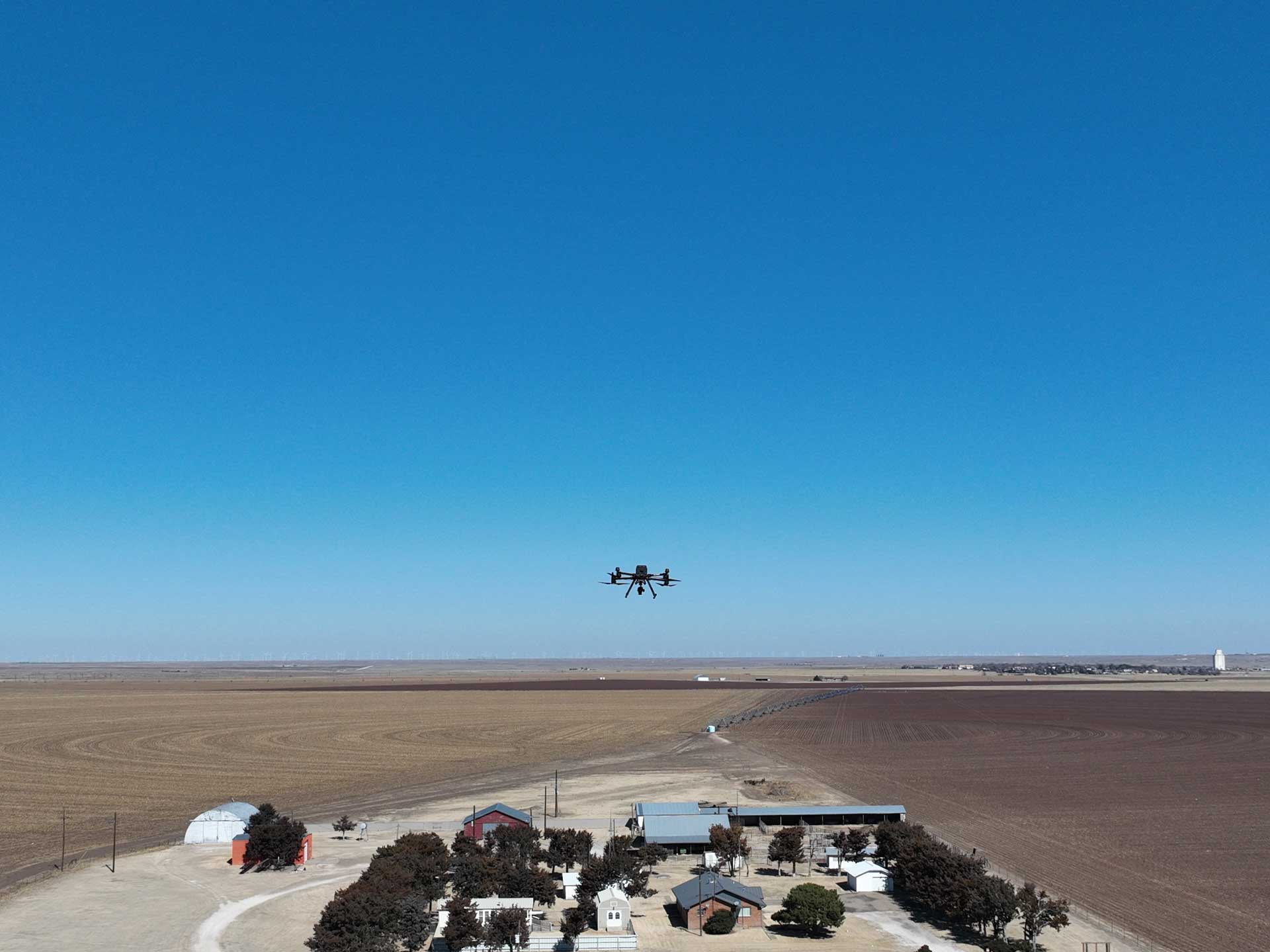
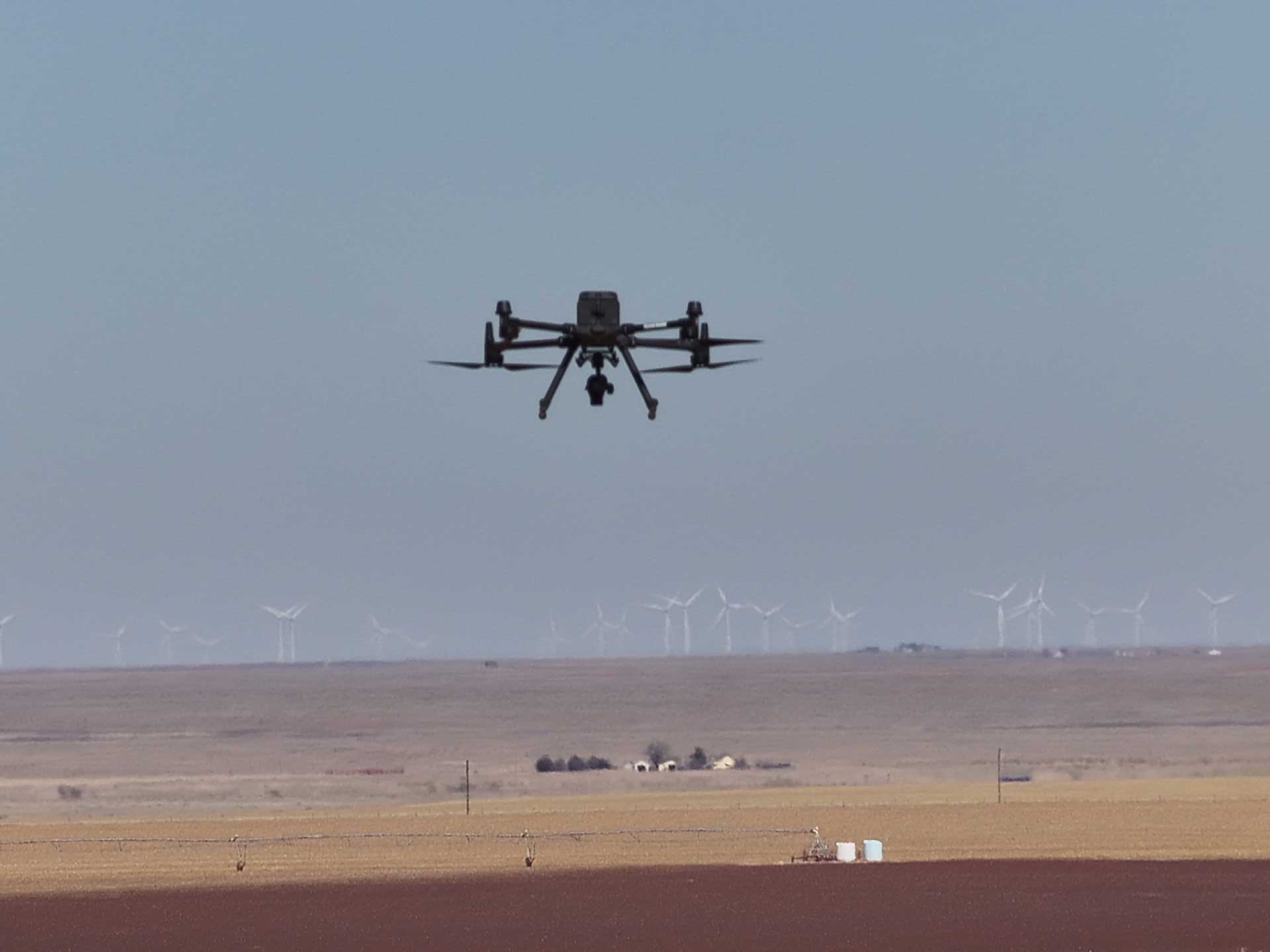
Equipment Used for Photogrammetry Mapping
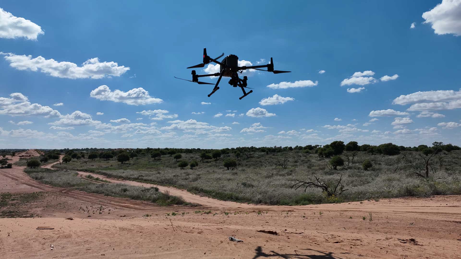
Tex-Air Drone uses professional RGB mapping drones and reality capture tools for infrastructure photogrammetry.
DJI Matrice 4E
Tex-Air Drone uses the DJI Matrice 4E for high-resolution RGB mapping, nadir imagery, oblique imagery, facade capture, structure documentation, construction progress imagery, infrastructure site mapping, and 3D photogrammetry workflows.
The Matrice 4E is a strong fit for industrial and infrastructure mapping because it can capture detailed visual data from multiple angles, supporting 2D orthomosaics, 3D site models, facade imagery, and repeatable project documentation.
DJI Matrice 350 RTK
Tex-Air Drone uses the DJI Matrice 350 RTK for advanced aerial mapping workflows and larger infrastructure sites where RTK-capable aircraft operations are needed.
The Matrice 350 RTK supports professional mapping operations over construction sites, industrial facilities, infrastructure corridors, solar sites, and large project areas.
Emlid RS3 Base Stations and Rovers
Tex-Air Drone uses Emlid RS3 base stations and rovers with ground control point workflows when higher mapping accuracy and stronger data alignment are needed.
Ground control helps improve confidence in photogrammetry outputs, especially for construction sites, infrastructure corridors, commercial developments, and industrial projects.
Technical Deliverables and Common File Types
Final deliverables depend on project scope, image capture requirements, processing workflow, accuracy needs, and client use case.
| Photogrammetry Method | Common Deliverables | Common File Types | Common Use Cases |
| Nadir Mapping | 2D orthomosaics, site maps, corridor maps, progress maps | GeoTIFF, JPG, PDF, KML, KMZ | Pipeline corridors, utility ROW, construction, industrial sites |
| Oblique Mapping | Angled imagery, 3D visual models, textured meshes | JPG image sets, OBJ, FBX, cloud links | Structures, site context, construction progress, digital twins |
| Facade Mapping | Vertical image sets, structure documentation, defect imagery | TIFF, JPG, PDF reports | Buildings, tanks, walls, industrial structures, facade review |
| RGB Site Mapping | High-resolution visual records, site exhibits, progress documentation | JPG, TIFF, PDF, cloud links | Oil and gas, utilities, infrastructure, construction |
| PortalCam Capture | Walk-throughs, Gaussian splats, digital site records | Platform-specific files, cloud links | Facility capture, asset documentation, remote review |
Software and Cloud Delivery
Tex-Air Drone uses professional photogrammetry, mapping, and reality capture software to process and deliver project data.
Our mapping software ecosystem includes:
- PIX4D Matic
- DJI Terra
- DJI Pilot 2
- XGRIDS LCC Scan
- Splat Lab
- Prevu3D
Photogrammetry data, RGB imagery, 2D orthomosaics, 3D visual models, facade image sets, and reality capture files can be shared through cloud-based project links when appropriate. Cloud delivery helps owners, engineers, surveyors, contractors, asset managers, and project stakeholders review data without waiting on large manual file transfers.
Accuracy, RTK and Ground Control
Photogrammetry mapping accuracy depends on several factors, including aircraft, camera, flight altitude, image overlap, ground control, RTK quality, lighting, site conditions, and processing workflow.
Tex-Air Drone uses RTK-capable aircraft and Emlid RS3 base station and rover workflows with ground control points when higher accuracy and stronger data alignment are required.
Because every site is different, Tex-Air Drone evaluates the project scope before recommending the right photogrammetry workflow.
Safety and Compliance
Tex-Air Drone operates with a professional safety-first approach. Our pilots are FAA Part 107 licensed, and each mission is planned around airspace, site conditions, obstacles, people, equipment, weather, and client requirements.
Our mapping operations may include:
- FAA Part 107 licensed pilots
- Pre-flight planning
- Site safety review
- Airspace checks
- Weather checks
- Equipment checks
- Mission planning
- Landing zone planning
- Ground control planning when required
- Jobsite coordination with client teams
- Professional field conduct and PPE when required by the site
For industrial, construction, solar, oil and gas, utility, and infrastructure projects, Tex-Air Drone works with the client’s site-specific safety requirements before flight operations begin.
Why Choose Tex-Air Drone for Photogrammetry Mapping?
Tex-Air Drone combines professional RGB mapping drones, RTK workflows, ground control support, oblique imagery, facade capture, and 3D reality capture into one focused infrastructure mapping service.
Clients choose Tex-Air Drone because we provide:
- Photogrammetry drone mapping services in Texas, New Mexico, and Oklahoma
- 2D orthomosaic mapping
- RGB aerial site documentation
- Nadir mapping
- Oblique drone imagery
- Facade mapping
- 3D photogrammetry models
- Textured visual models
- Pipeline corridor visual mapping
- Utility right-of-way documentation
- Oil and gas site mapping
- Critical infrastructure mapping
- Construction progress mapping
- Solar site mapping
- Cloud-based project data delivery
- Support for engineers, surveyors, contractors, utilities, asset managers, and infrastructure owners
Tex-Air Drone helps clients see more, document more, and make better decisions from better visual data.
FAQ
What is photogrammetry drone mapping?
Photogrammetry drone mapping uses overlapping aerial images to create maps, models, and visual site records. It is commonly used for 2D orthomosaic maps, 3D models, construction progress documentation, pipeline corridor mapping, and infrastructure site records.
What is RGB drone mapping?
RGB drone mapping uses standard red, green, and blue visual imagery to document a site in high resolution. RGB mapping is useful for construction, oil and gas, pipelines, utilities, solar sites, industrial facilities, and critical infrastructure.
What is a 2D orthomosaic map?
A 2D orthomosaic map is a high-resolution aerial map created by stitching many drone images into one corrected, continuous image. It gives project teams a current top-down view of the site.
What is nadir mapping?
Nadir mapping captures imagery straight down from above the site. It is commonly used for orthomosaic maps, pipeline corridor documentation, utility right-of-way mapping, construction progress maps, and site layout documentation.
What is oblique mapping?
Oblique mapping captures angled imagery that shows the sides of buildings, structures, equipment, tanks, and terrain. It is useful for 3D models, site context, construction documentation, and asset review.
What is facade mapping?
Facade mapping captures vertical surfaces such as building exteriors, tanks, walls, towers, and industrial structures. It helps document vertical assets for maintenance, engineering review, construction progress, and asset records.
Can Tex-Air Drone map pipeline corridors and rights-of-way?
Yes. Tex-Air Drone can provide RGB photogrammetry mapping for pipeline corridors, right-of-way documentation, access roads, construction progress, erosion review, storm damage records, and corridor condition documentation.
Can Tex-Air Drone map oil and gas sites?
Yes. Tex-Air Drone can map well pads, tank batteries, compressor stations, access roads, pipeline facilities, industrial yards, and site expansion areas using RGB photogrammetry, nadir imagery, oblique imagery, and 3D visual models.
Does this page include LiDAR mapping?
This page focuses on RGB photogrammetry, 2D orthomosaics, nadir imagery, oblique imagery, facade mapping, and 3D visual models. For LiDAR point clouds, TOPO support, planimetrics, contours, DTM, DSM, DEM, and CAD/GIS deliverables, visit Tex-Air Drone’s dedicated LiDAR mapping page.
Does Tex-Air Drone replace surveyors?
No. Tex-Air Drone is not a licensed surveying company. We provide aerial imagery and photogrammetry-based mapping data that supports licensed surveyors, engineers, contractors, infrastructure owners, and asset managers.
How is mapping data delivered?
Depending on the project, data can be delivered through cloud links, downloadable files, PDF exhibits, orthomosaic maps, imagery sets, 3D models, textured meshes, facade documentation, or project-specific deliverable packages.
Request a Photogrammetry Drone Mapping Quote
If you need RGB drone mapping for oil and gas, pipelines, utilities, solar sites, industrial facilities, construction, or critical infrastructure, Tex-Air Drone can help capture the data and deliver it in a format your team can use.
To request a mapping quote, please provide:
- Project location
- Type of site or infrastructure
- Approximate acreage, corridor length, or site size
- Mapping goal
- Required deliverables
- Accuracy requirements, if known
- Preferred timeline
- Whether 2D orthomosaic, nadir, oblique, facade,
3D model, or PortalCam capture is needed
Tex-Air Drone will review the project and recommend the right photogrammetry workflow for your site.