Professional Agricultural Drone Services


Agriculture Drone Services Overview
Our precision drone technology delivers faster field coverage, reduced soil compaction, and data-driven crop management—helping farmers protect yields while maximizing operational efficiency through professional agriculture drone services.
Services
Tex-Air Drone provides precision aerial services designed to help farmers and ranchers make better decisions, cover more acres, and reduce input costs. Using advanced drone technology and field data analytics, we deliver fast, accurate insights that improve crop management and operational efficiency across every acre.
Our Precision Agriculture Services Include:
-
Drone Spraying Targeted application of crop protection products to minimize waste and maximize efficacy.
-
Weed Detection High-resolution mapping to identify and manage weed pressure with pinpoint accuracy.
-
Variable Rate Prescriptions Data-driven maps that can be downloaded directly to our spray drones or your own equipment to optimize input distribution and significantly reduce chemical consumption.
-
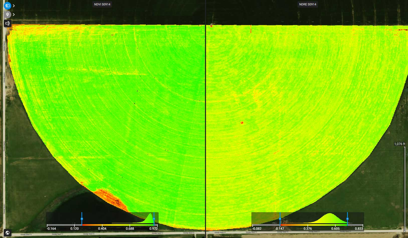
Multispectral Imaging Advanced aerial sensors that monitor crop health, vigor, and stress levels before they are visible to the naked eye.
-
Stand Count Analysis Automated, accurate plant population counts to evaluate emergence and inform replant decisions.
Precision Agriculture Driven by an Advanced Drone Fleet
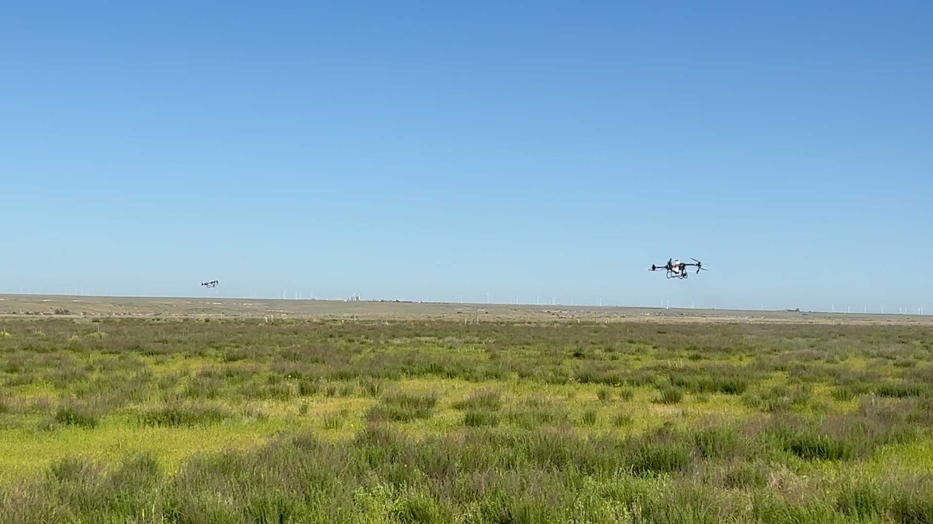
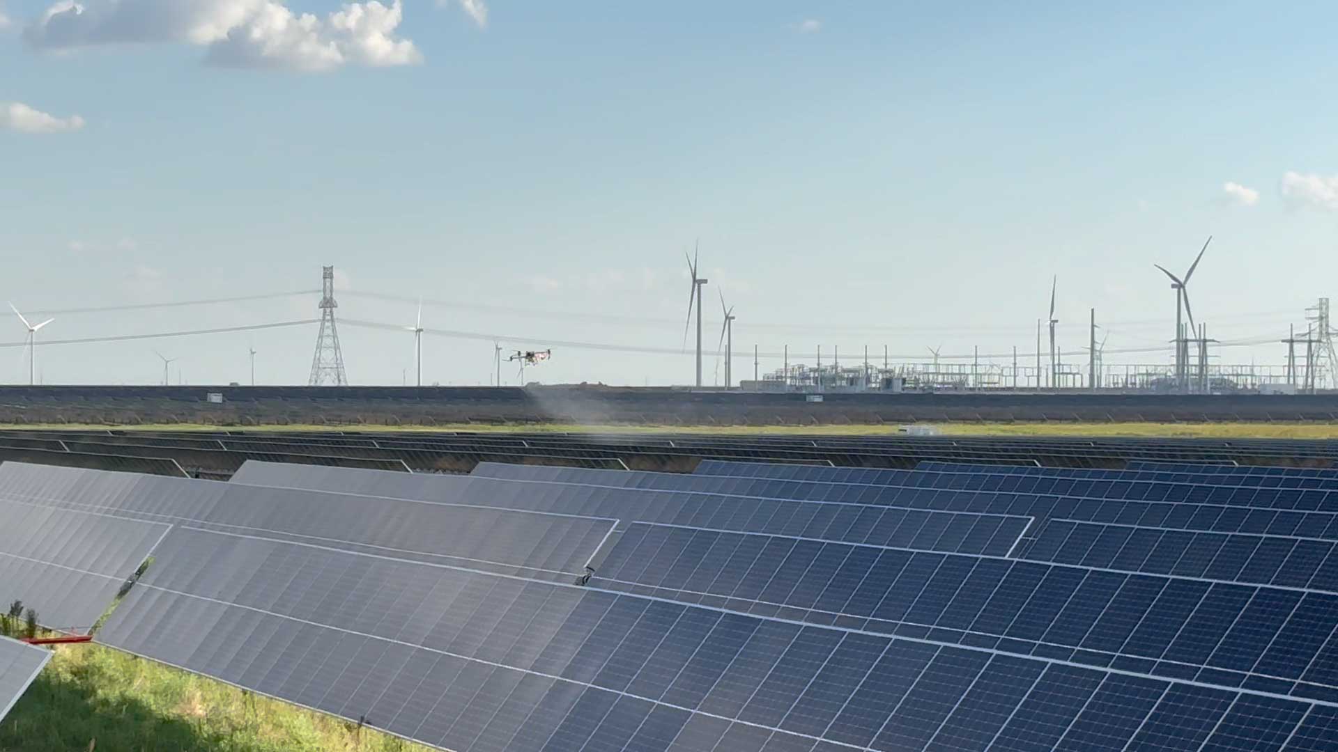
At Tex-Air Drone, we combine cutting-edge aerial technology with agronomic data to help producers across Texas protect yields and lower input costs. Our operation uses a diverse fleet of 8 specialized agricultural drones for crop, range & pasture application.
Next-Gen Spraying Capabilities
Tex-Air Drone operates multiple DJI T100, T50, and T25 agricultural spray drones. Our fleet allows simultaneous deployment across multiple fields, helping producers complete large-
acreage projects efficiently during critical application windows.
We provide rapid, precise field applications that eliminate soil compaction and completely bypass the crop damage caused by traditional ground rigs. Our advanced application fleet includes:
DJI Agras T100 – Engineered for maximum payload capacity and broadacre efficiency.
DJI Agras T50 – Delivering optimized swath widths and superior droplet penetration.
DJI Agras T25 – Perfect for nimble, targeted applications and tight field boundaries
Elite Aerial Mapping & Crop Scouting
To make informed management decisions, you need accurate data. The remainder of our fleet features industry-leading mapping platforms—including the Matrice 350 RTK, Matrice 4E, and Mavic 3M—built to capture every square inch of your fields with pinpoint geographic accuracy.
Turn Aerial Insights Into Actionable Prescriptions
Data is only valuable if it’s actionable. By equipping our flagship Matrice 350 RTK with state-of-the-art sensor payloads, Tex-Air Drone delivers custom, data-driven solutions directly to your regular farm equipment.
Variable Rate Fertilizer Prescriptions
Using the Sentera 6X Thermal Pro Multispectral Sensor, we map crop stress and chlorophyll levels across your acreage. This data allows us to build high-accuracy Variable Rate Prescriptions for fertilizer applications, ensuring you only apply nutrients exactly where your soil and crops require them.
Precision Weed Detection & Identification
Equipped with the high-resolution Sentera 65R RGB Sensor, we capture ultra-crisp imagery to power advanced weed detection and prescription identification. By pinpointing exact weed pressure zones, we generate precise spot-spraying maps that drastically cut chemical costs and reduce environmental impact.
Kochia: Detect and map fast-growing, herbicide-resistant kochia populations early to execute high-precision spot-spraying before it chokes out your cash crops.
Bindweed: Locate deep-rooted bindweed patches across your acreage, delivering targeted aerial applications to stop its aggressive, strangling spread and protect harvest efficiency.
Johnsongrass: Pinpoint invasive Johnsongrass infestations along field borders and within rows, preventing this rapid spreader from stealing vital soil nutrients and light from high-yield crops.
Nutsedge: Map stubborn nutsedge outbreaks in low-lying or poorly drained zones, enabling highly localized chemical applications to eliminate these persistent, moisture-robbing perennial invaders.
Seamless John Deere Operations Center Integration
We work with your existing workflow. All of our custom application maps and data-driven prescriptions can be uploaded directly to the John Deere Operations Center. This seamless integration gives you complete operational flexibility—we can handle the drone applications for you, or you can effortlessly download the prescription files to your own precision ag equipment to spray or fertilize on your own schedule.
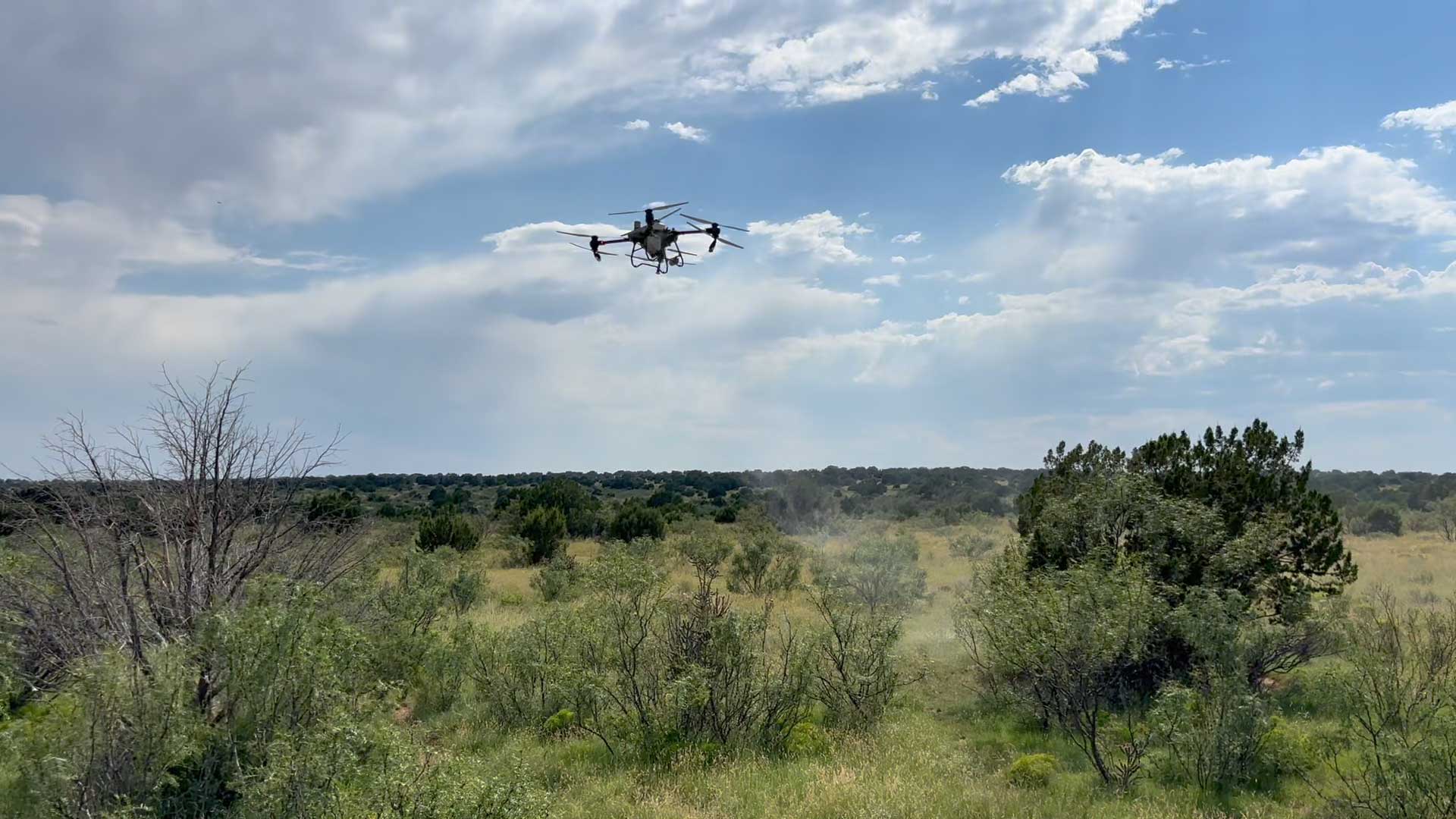
Large-Scale Range Management & Brush Control
We have successfully sprayed thousands of acres across Texas and New Mexico, providing cattlemen, ranchers, and landowners with highly effective, targeted brush control solutions to restore valuable grazing acres.
Advanced Pasture Restoration & Invasive Species Control
Traditional ground rigs struggle with rough terrain, while heavy aircraft lack precision. Tex-Air Drone delivers deep canopy penetration and pinpoint accuracy to eradicate resource-draining brush and invasive species, including:
Mesquite: Eliminate deep-rooted, water-hogging mesquite canopy infestations to significantly boost forage production.
Prickly Pear: Deliver precise chemical targeting to control stubborn cactus spread without damaging critical native grasses.
Cholla: Achieve comprehensive aerial coverage to manage high-density cholla populations in arid, rugged pastures.
Sage (Sagebrush): Deploy tailored application strategies to suppress aggressive sage growth and fully reclaim open rangeland.
Persimmon: Leaves have slick, waxy cuticle, standard broadcast applications often suffer from poor chemical absorption, precision drone application solves this.
Mixed Brush & Woody Species: Comprehensive aerial solutions designed to penetrate dense brush and restore optimal ecological balance to your land.
Why Landowners Choose Tex-Air Drone: Our advanced drone fleet completely bypasses challenging topography, avoids soil compaction, and drastically reduces chemical waste through data-driven variable-rate technology
AGRICULTURAL DRONE SERVICES IN AMARILLO, TX
We provide agricultural drone services for projects across the region, including agricultural drone services in Amarillo, TX,
supported by aerial mapping and data analysis to improve crop monitoring, irrigation management, and precision agriculture operations.
Serving Amarillo, TX and the Texas Panhandle.
Network Affiliations

Case Studies
Bison Operation Fly Control
In 2024 Tex-Air Drone was employed to combat a severe fly infestation causing disruptions in the operations at Frasier Bison LLC
-
The Result Fly populations were reduced to zero. Find out more by checking out the full study below.
Lost Pasture Restoration
A section of the Davis Cattle Company ranch was unusable due to major overgrowth. Tex-Air Drone was called to handle the situation.
-
The Result The field is free and clean, allowing the company to run more cattle. Find out more by checking out the full study below.