Comprehensive Thermal Drone Inspections


Thermal Inspection
Tex-Air Drone uses advanced thermal imaging sensors to detect heat anomalies that indicate potential equipment failures, irrigation concerns, crop stress, or performance issues. Our aerial thermal inspections help identify faults in solar arrays, electrical infrastructure, field conditions, and industrial equipment, allowing operators to quickly identify and address problems before they become costly failures.
INDUSTRIAL SOLAR THERMAL DRONE INSPECTIONS:
TEXAS, NEW MEXICO & OKLAHOMA
Our advanced aerial thermography detects hidden anomalies, localized faults, and systemic asset degradation, translating raw thermal signatures into actionable, measurable business intelligence.
INTERACTIVE CLOUD-HOSTED THERMAL PORTALS
We don't just hand you a folder full of unorganized static images. Your aerial inspection data is compiled into a clear, high-resolution thermal map (orthomosaic). It is delivered through a secure, cloud-hosted web link. Your asset management and O&M teams can log in from any device to interact with the asset directly:
- Pixel-Level Temperature Tracking: Click anywhere on your solar farm map to instantly see exact, calibrated temperature data. It shows readings down to a fraction of a degree.
- On-Screen Annotation Suite: Add geotagged pins to failing strings or damaged panels. Add field notes and set priority levels for repair technicians.
- Precise Spatial Measurements: Measure exact damage footprints, calculate distances for equipment routing, and track specific array coordinates.
- Frictionless Team Sharing: Instantly share a secure, interactive link with off-site stakeholders, engineering teams, or insurance adjusters. No large software downloads or CAD licenses are required.
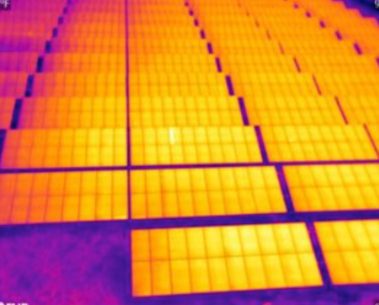
RADIOMETRIC DEFECT DETECTION & SOLAR O&M
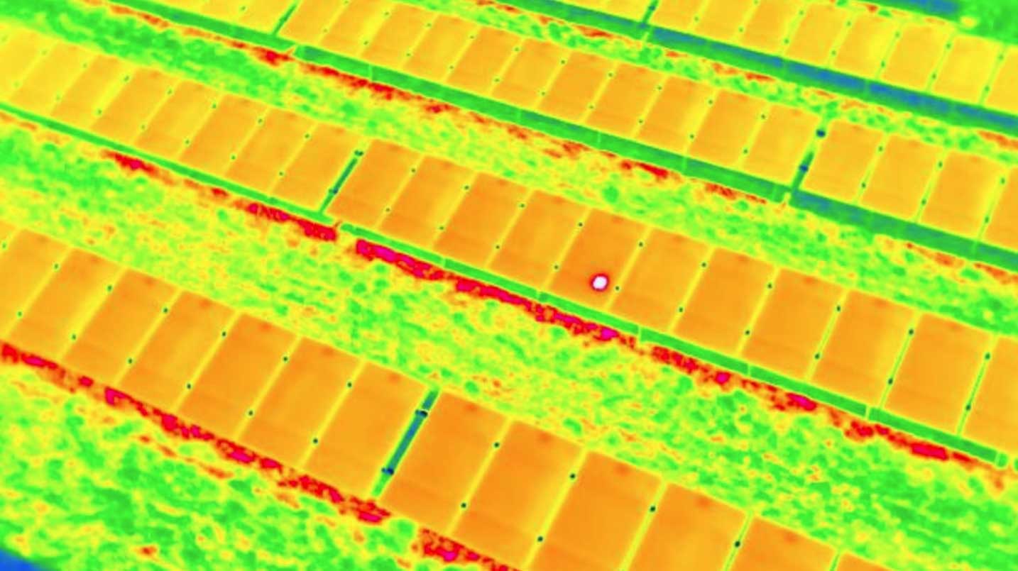
By deploying centimeter-accurate, RTK-stabilized aerial mapping platforms equipped with high-resolution radiometric sensors, we capture clear thermal discrepancies across vast acreage. Our solar inspections identify a wide spectrum of performance-draining anomalies:
- String & Combiner Box Outages: Find strings or array sections that are completely offline. This can happen because of inverter or wiring faults.
- Cell-Level Hot Spots: Find single-cell failures, cracked glass, and bypassed diodes that cause hot spots. These hot spots speed up panel wear.
- Soiling & Environmental Anomalies: Differentiate between mechanical electrical faults and thermal irregularities caused by dust accumulation, vegetation overgrowth, or avian nesting.
- Visual-to-Thermal Overlays: Easily switch between ultra-high-resolution visual images and radiometric thermal maps. This helps confirm if a hot spot is an asset defect or a reflection.
SERVING THE SOUTHWEST SOLAR GRID
The environments of Texas, New Mexico, and Oklahoma demand rugged, high-frequency asset monitoring. We tailor our operations to handle the unique regional challenges of the Southwest:
- Texas (ERCOT Grid Support): Rapid scans of large utility-scale fields from West Texas to the Panhandle. This helps ensure peak output during high-demand summer months.
- New Mexico: High-altitude, dust-resistant scanning optimized to detect sand and soiling losses. It also helps identify thermal stress in high-desert solar sites.
- Oklahoma: Fast thermal audits after severe storms to map hail damage, small cracks, and wind damage for claims.
Frequently Asked Questions About Thermal Drone Inspections
How long does it take to scan a multi-megawatt solar farm?
Because we utilize high-speed, RTK-stabilized enterprise flight platforms, we can map hundreds of acres of solar arrays in a single day, eliminating the weeks of manual labor required for handheld ground inspections.
What specific data formats can we export from the interactive link?
While the cloud portal allows full interactive measurement and annotation, you can export geotagged defect maps.
You can also export CSV files with anomaly coordinates and complete PDF inspection reports.
These files can plug directly into your existing CMMS or O&M workflows.
Are these aerial thermal scans compliant with international inspection standards?
Yes. Our radiometric imaging workflows align with IEC TS 62446-3 standards for outdoor infrared thermography of photovoltaic modules, providing you with certified, audit-ready documentation.
Thermal Drone Inspection Services in Amarillo, TX
We provide thermal drone imaging for projects across the region, including thermal inspection services in Amarillo, TX, supporting construction, land development, and infrastructure planning.
Serving Amarillo, TX and the Texas Panhandle.