Drone LiDAR Mapping Services in Texas
Survey-Grade LiDAR Data Collection for Engineering, Construction, Utilities and Land Development
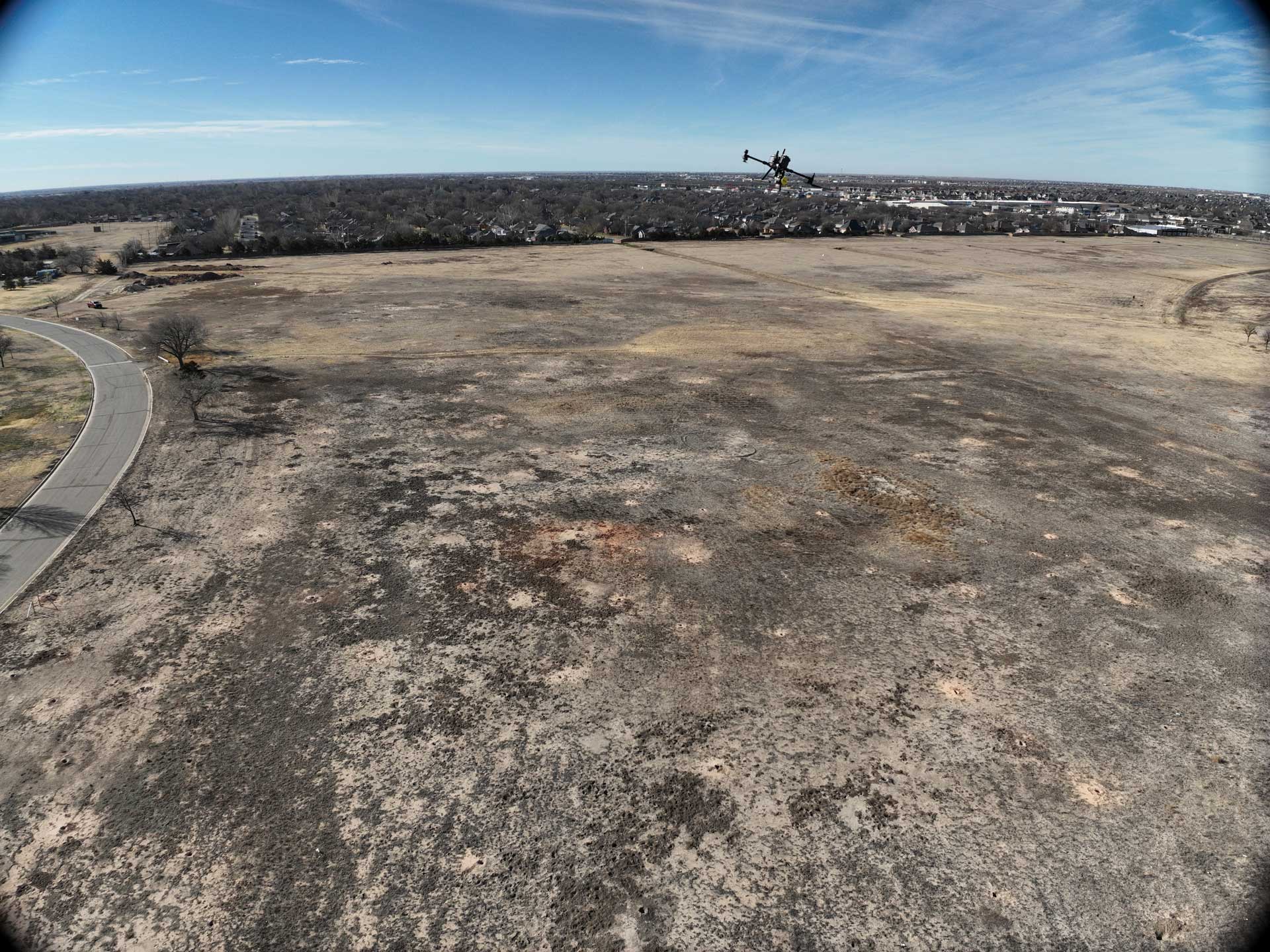
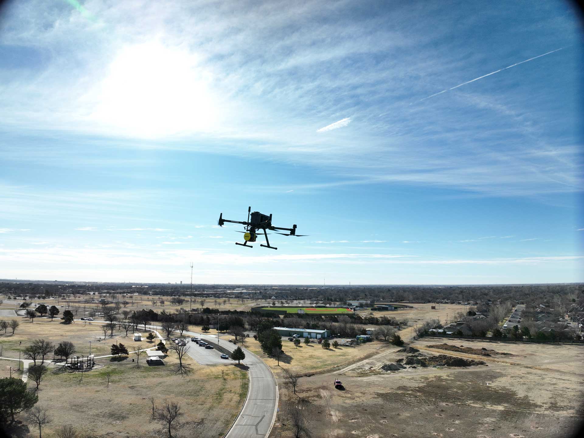
Tex-Air Drone provides professional drone LiDAR mapping services throughout Texas using advanced airborne laser scanning technology. Our LiDAR workflows support civil engineering firms, survey professionals, construction companies, utility operators, transportation agencies, environmental consultants, and land developers requiring accurate geospatial information.
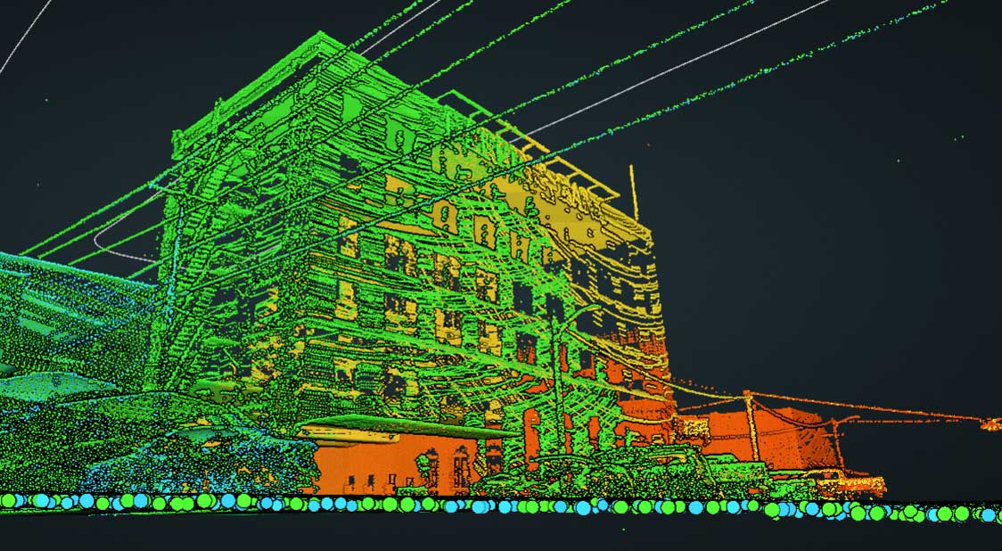
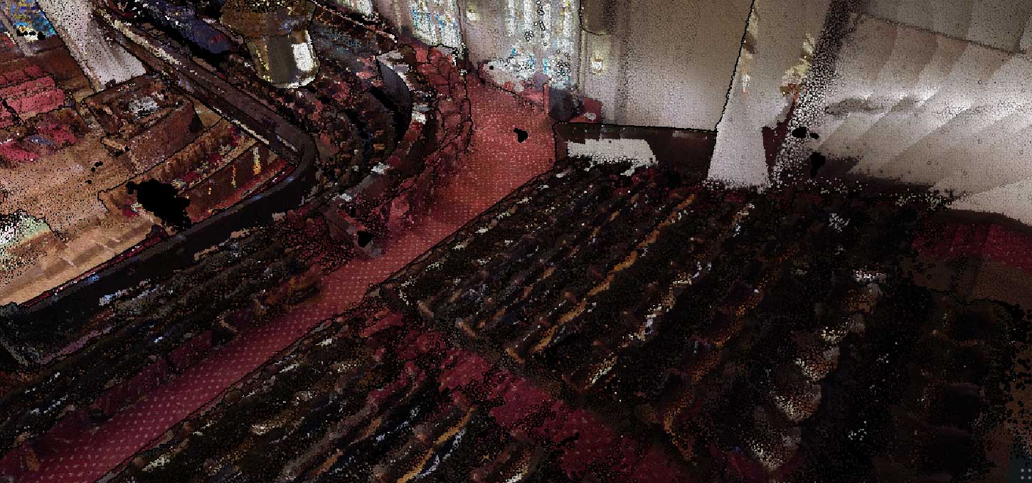
Drone LiDAR technology captures millions of elevation measurements across a project site, creating highly detailed three-dimensional representations of terrain, vegetation, structures, and infrastructure assets. Unlike traditional aerial photography alone, LiDAR actively measures elevation, allowing accurate terrain modeling even in heavily vegetated areas where conventional photogrammetry may struggle.
Our data acquisition workflow combines high-density LiDAR collection, RTK positioning, quality control procedures, and processing through Rock Pro Services to deliver accurate geospatial datasets that support planning, design, construction, asset management, and environmental analysis projects throughout Texas.


Why Organizations Use Drone LiDAR Mapping
Organizations across multiple industries rely on accurate spatial information to make informed decisions. Traditional field collection methods often require extensive manpower, longer project schedules, and increased safety exposure.
Drone LiDAR mapping offers significant advantages:
- Rapid data collection over large areas
- Reduced field time and site disruption
- Accurate elevation information
- High-density point cloud generation
- Vegetation penetration capabilities
- Repeatable project monitoring
- Improved project documentation
Whether supporting a transportation corridor, utility right-of-way, construction site, or land development project, LiDAR provides detailed information that can be used throughout the project lifecycle.
Industries We Serve
-
Civil Engineering
-
Construction
-
Survey Support
-
Utility Infrastructure
-
Transportation
-
Oil & Gas
-
Environmental Consulting
-
Forestry
-
Municipal Government
-
Land Development
Our LiDAR Deliverables
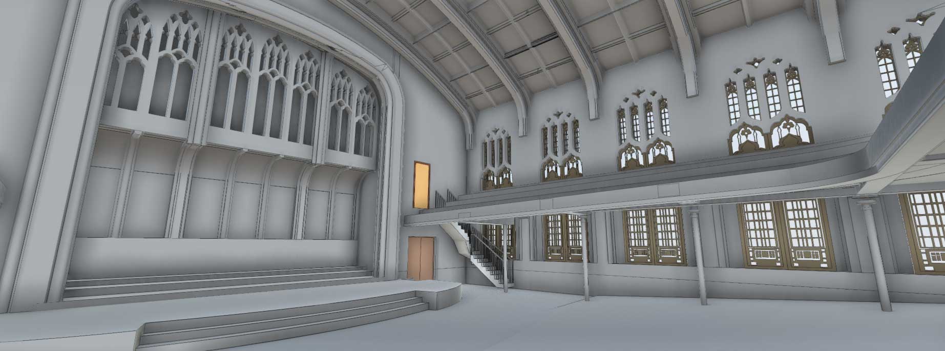
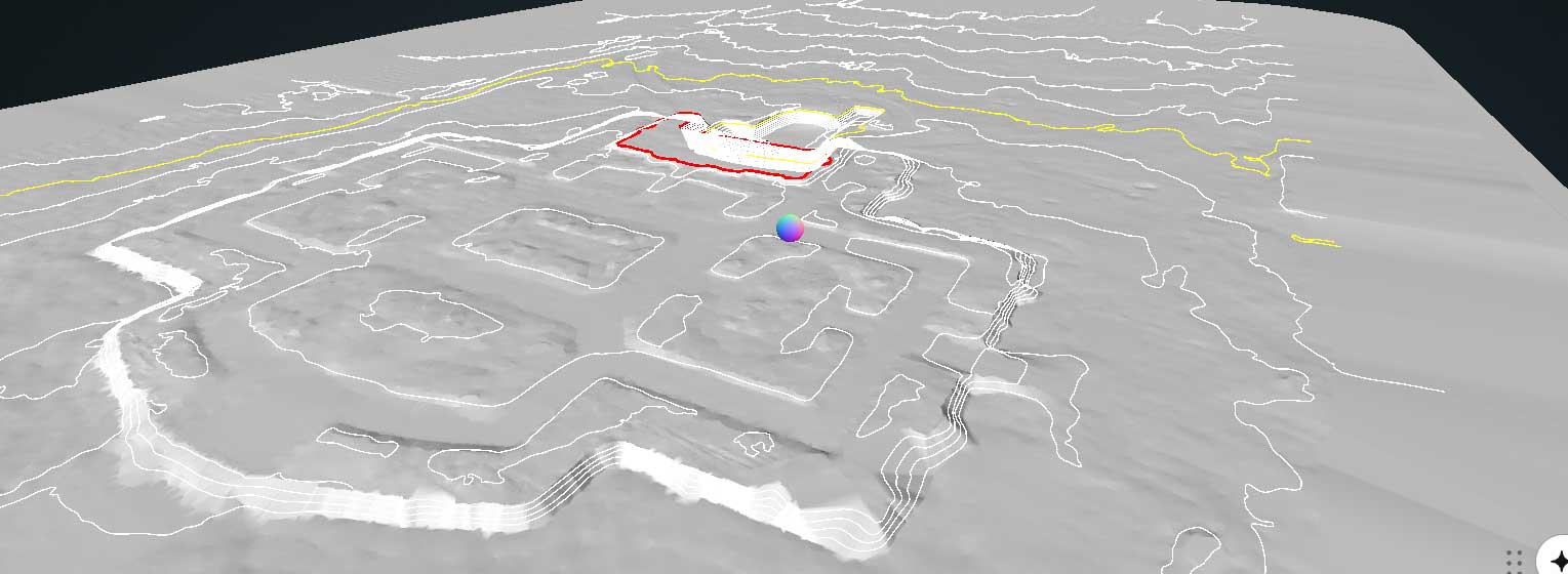
Tex-Air Drone converts LiDAR data into accurate geospatial products ready for engineering, surveying, and asset management workflows. From high-resolution point clouds, we generate detailed planimetric maps, contour lines, and digital elevation models that reveal true ground conditions—even beneath dense vegetation. Our LiDAR datasets can also be processed into BIM-compatible 3D models and digital terrain products suitable for CAD, GIS, and infrastructure planning platforms.
Deliverables generated through Rock Pro Services may include:
- Classified LAS and LAZ Point Clouds
- Digital Terrain Models (DTM)
- Digital Surface Models (DSM)
- Digital Elevation Models (DEM)
- Topographic Contours
- Orthomosaic Imagery
- Colorized Point Clouds
- Cross Sections
- Terrain Profiles
- Volumetric Measurements
- GIS Compatible Deliverables
- CAD Compatible Deliverables
faq
What is drone LiDAR mapping?
Drone LiDAR (Light Detection and Ranging) is a surveying technology that uses laser pulses to create an extremely accurate 3D representation of the ground and everything on it.
Using our ROCK R3 Pro V2 LiDAR system, we capture hundreds of thousands of measurements every second while the drone flies over your project. Combined with RTK/PPK GNSS positioning and a high-precision Inertial Measurement Unit (IMU), these measurements are processed into a dense 3D point cloud—often referred to as a digital twin of the site.
Unlike traditional aerial photography, LiDAR accurately measures terrain, elevation, vegetation, buildings, utility corridors, and infrastructure—even in areas where photogrammetry struggles.
How accurate is drone LiDAR?
Drone LiDAR delivers survey-grade accuracy when collected and processed using proper workflows.
At Tex-Air Drone, our Rock Robotic workflow combined with RTK/PPK positioning and ground control typically achieves:
Horizontal Accuracy: 1–3 cm
Vertical Accuracy: 2–3 cm
On flat, hard surfaces such as highways, runways, and parking lots, vertical accuracy can be as precise as 1.65 cm RMSE, making the data suitable for engineering design, construction, and infrastructure projects.
Can LiDAR see through trees?
Not exactly—but it can see through gaps in vegetation.
Each laser pulse can produce multiple returns. Some pulses strike the tree canopy, while others pass through openings between leaves and branches until they reach the ground.
This allows LiDAR to accurately map the terrain beneath dense trees and brush, making it ideal for forestry, utility corridors, flood studies, and topographic surveys where conventional drone photography cannot accurately capture the ground.
What is a classified point cloud?
A point cloud contains millions of individual 3D measurements captured during a LiDAR survey.
Classification organizes those points into meaningful categories, such as:
- Ground (Bare Earth)
- Vegetation
- Buildings
- Roads
- Bridges
- Power Lines
- Utility Structures
Classification allows engineers and surveyors to isolate only the information they need—for example, removing vegetation to create an accurate bare-earth terrain model.
What file formats do you provide?
Point Clouds
- LAS
- LAZ
- E57
- PLY
- PTS
Surface Models & Imagery
- GeoTIFF
- DEM
- DSM
- DTM
- Orthomosaic
- KMZ/KML
CAD & GIS Deliverables
- DWG
- DXF
- LandXML
- Shapefile (SHP)
- GeoPackage (GPKG)
- CSV Coordinates
Custom deliverables are available to meet your project’s specific software requirements.
How many acres can you map in a day?
Coverage depends on terrain, vegetation, flight altitude, and project requirements.
Under typical conditions, our LiDAR systems can map 1,000 acres or more per day while maintaining survey-grade accuracy.
Large corridor, agricultural, ranch, and infrastructure projects can often be completed significantly faster than traditional ground surveying methods.
What is the difference between a DTM and a DSM?
Digital Surface Model (DSM)
A DSM represents everything visible from above, including:
- Buildings
- Trees
- Vehicles
- Power lines
- Bridges
- Ground surface
This model is useful for construction planning, solar analysis, and line-of-sight studies.
Digital Terrain Model (DTM)
A DTM removes vegetation and structures to reveal the actual ground surface.
DTMs are commonly used for:
- Civil engineering
- Drainage design
- Flood modeling
- Earthwork calculations
- Topographic mapping
How is LiDAR used in construction?
Drone LiDAR has become an essential tool throughout the construction lifecycle.
Common applications include:
- Earthwork quantity calculations
- Cut-and-fill analysis
- Stockpile volume measurements
- Progress monitoring
- As-built documentation
- Site grading verification
- BIM and CAD comparisons
- Contractor quantity verification
Frequent drone surveys create a permanent, highly accurate record of site conditions, helping reduce costly rework, improve project documentation, and resolve quantity disputes.
Can LiDAR data be used for engineering design?
Yes. Our deliverables are designed specifically for engineering workflows.
We provide engineering-ready products including:
- Bare-earth terrain models
- Contours
- Breaklines
- LandXML surfaces
- Planimetric feature extraction
- Utility corridor mapping
- CAD-ready datasets
These deliverables integrate directly into platforms such as:
- AutoCAD Civil 3D
- MicroStation
- ArcGIS Pro
- QGIS
- Bentley OpenRoads
- PLS-CADD
- Autodesk ReCap
- Revit
- Other BIM and GIS software
What industries benefit from drone LiDAR?
Drone LiDAR is valuable anywhere highly accurate elevation and 3D data are needed.
Land Surveying & Civil Engineering
- Topographic surveys
- Site planning
- ALTA/NSPS support
- Corridor mapping
- Design surfaces
Construction
- Earthwork monitoring
- Cut/fill calculations
- As-built verification
- Progress documentation
- Stockpile measurements
Utilities & Energy
- Transmission corridor mapping
- Vegetation management
- Asset inventories
- Solar and wind farm planning
- Pipeline inspections
Agriculture & Ranching
- Drainage analysis
- Field grading
- Irrigation planning
- Ranch infrastructure mapping
- Watershed management
Forestry & Environmental
- Forest inventory
- Canopy analysis
- Habitat mapping
- Wetland delineation
- Erosion assessment
- Floodplain modeling
LiDAR Services in TEXAS, New Mexico, and Oklahoma
We provide LiDAR drone scanning for projects across the region, including commercial drone services in Amarillo, TX, where we support construction, land development, and infrastructure planning.
Serving Amarillo, TX and the Texas Panhandle.