On any active earthwork project — a highway interchange, a land development site, a gravel pit, a retention pond, a pipeline corridor — there is one number that every project manager, owner, and estimator needs to know with confidence: how much material is actually there. How much has moved. How much remains. Whether what the contractor billed for matches what actually happened on the ground.
For most of the history of construction, getting that number accurately required a survey crew, a set of grade stakes, a significant block of time, and the acceptance that the resulting measurement was a reasonable approximation of ground truth rather than ground truth itself. GPS rovers and total stations improved the accuracy of those measurements substantially, but the fundamental constraints remained: survey crews work a site sequentially, not simultaneously. Large sites take days to measure. Stockpiles that change daily are measured weekly or monthly. The data is always slightly behind the reality.
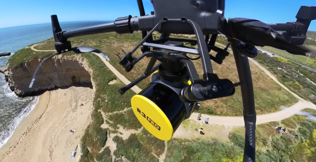
Drone-based volumetric measurement changes that relationship between time and accuracy. A drone flight over a construction site or aggregate operation captures millions of individual elevation measurements across an entire area in a single pass — a data density that no ground survey crew can practically match. Processed through photogrammetric software, that raw imagery becomes a precise three-dimensional surface model from which cut volumes, fill volumes, stockpile quantities, and terrain change calculations can be extracted with engineering-grade accuracy.
Tex-Air Drone provides volumetric measurement services to construction, civil engineering, and earthwork operations across Texas, Oklahoma, and New Mexico — delivering the spatial data that project managers, owners, and material managers need to make accurate, confident decisions about the ground beneath their projects.
What Drone Volumetrics Actually Measures and How
Understanding why drone volumetric measurement is as accurate as it is requires a brief look at the underlying process.
When a drone flies a systematic grid pattern over a construction site, it captures thousands of overlapping photographs from slightly different positions. The overlap between adjacent images — typically 75 to 85 percent in professional survey-grade workflows — allows photogrammetric processing software to identify common features across multiple images and reconstruct the precise three-dimensional position of every visible point on the ground surface. The result is a dense point cloud: millions of georeferenced elevation measurements covering every square foot of the project area.
From that point cloud, a Digital Surface Model (DSM) is generated — a continuous, georeferenced elevation grid that represents the actual shape of the terrain, stockpile, or earthwork area at the moment the drone flew. When two DSMs from different dates are compared — a pre-construction surface against a mid-project surface, or a current stockpile model against the previous month’s model — the software calculates the difference between the two surfaces volume by volume across every cell of the comparison grid.
The resulting cut/fill calculation is not an estimate based on a sample of points. It is a computation derived from the full spatial data of every photographed square foot of the site. On a large earthwork project, that distinction in data density translates directly into accuracy that a conventional survey rod-and-grid approach, which measures a subset of the site and interpolates between measurement points, cannot reliably match.
Tex-Air Drone’s aerial mapping capabilities — producing orthomosaic maps, elevation models, and 3D site models — are the foundational data layer from which these volumetric calculations are derived. The same flight and data processing workflow that produces a high-resolution visual record of site conditions simultaneously produces the numerical surface data that makes accurate volumetrics possible.
The Stockpile Problem: Why Traditional Measurement Falls Short
Aggregate operations — gravel pits, sand and gravel plants, crushed stone facilities, caliche yards — manage material inventories that change every working day. Trucks load and haul. Crushing and screening add to piles. Stockpiles change shape continuously, often in ways that make traditional measurement particularly difficult.
A survey crew measuring a large, irregular stockpile with a GPS rover faces several practical challenges. Access to the top of an active pile may require climbing equipment and creates safety exposure. Measuring the full perimeter and surface of a large pile takes time during which the pile may continue to change. The base boundary — where the pile contacts the ground — is often the most difficult measurement to make accurately because it is obscured by material spillage at the pile’s foot.
Drone measurement eliminates all of those constraints simultaneously. The drone captures the entire stockpile surface from above without any personnel accessing the pile itself, removing the safety exposure entirely. The flight captures the complete pile surface in minutes rather than the hours a ground survey would require. The data density of the resulting point cloud means that every slope, ridge, and irregular surface feature of the pile is captured — not interpolated between ground measurement points.
The base boundary calculation — essential for accurate volume — can be defined precisely in the processing software using the as-flown surface data, producing a more accurate and reproducible result than a field crew marking a physical boundary around the pile’s foot.
For operations that need inventory accuracy for financial reporting, customer billing, or regulatory compliance, the audit trail that drone measurement provides is an additional practical benefit. Each flight produces a georeferenced, time-stamped surface model that documents the exact state of inventory at the time of measurement — a permanent, verifiable record that a field sketch and GPS rover points cannot fully replicate.
Cut/Fill Tracking on Active Earthwork Projects
Highway construction, land development, lake and pond construction, pipeline right-of-way grading, commercial pad site preparation — across all of these project types, the fundamental challenge of earthwork management is the same: tracking material movement accurately enough to manage contractor payments, identify overruns before they become uncontrollable, and verify that graded surfaces meet design tolerances.
Cut/fill tracking by drone works by comparing a current surface model to a reference surface — either a pre-construction baseline survey or the project’s design surface imported as a digital terrain model. The comparison produces a map and calculation showing, for every part of the project area, how much material has been removed (cut), how much material has been added (fill), and what the net balance is across the project.
That calculation has several critical applications in active earthwork management.
Contractor payment verification. When a grading contractor submits a progress billing based on claimed earthwork quantities, a drone-based cut/fill calculation provides independent verification of those quantities against the actual surface conditions at the time of measurement. Discrepancies between claimed and measured quantities surface immediately rather than at project closeout when correction is no longer practical.
Material balance management. On balanced-cut projects where excavated material is intended to be reused as fill rather than hauled off-site, accurate cut/fill tracking is essential to confirming that the balance is being maintained. Unexpected imbalances — more cut than anticipated in one area, insufficient fill source in another — can be identified early enough to adjust the grading plan before haul costs escalate.
Design conformance verification. As graded surfaces approach their design elevations, drone-based surface modeling allows the project team to compare the actual graded surface against the design surface with spatial specificity — identifying areas that are above or below design grade across the full project footprint, not just at stake locations.
Dispute documentation. On projects where owner-contractor disputes arise over quantities, sequences, or site conditions, the time-stamped surface record produced by regular drone flights provides objective spatial documentation that can support or refute competing claims about what the site conditions were at any particular point in the project timeline.
Drone Volumetrics for the Oil and Gas and Energy Sectors
Texas, Oklahoma, and New Mexico represent some of the most active oil and gas production territories in North America, and the construction activity associated with that production — well pad preparation, production facility construction, pipeline corridor grading, tank battery installation, water impoundment construction — generates significant ongoing demand for earthwork measurement services.
Oilfield earthwork has several characteristics that make drone-based measurement particularly well-suited to the sector. Well pad projects are often in remote locations where mobilizing a survey crew involves substantial drive time and logistical cost. The pace of oilfield construction creates frequent measurement needs on tight timelines. And the regulatory environment around spill containment structures — secondary containment berms, lined impoundments, stormwater control features — requires documentation of constructed dimensions that a drone surface model supports more comprehensively than a field survey.
For water disposal and storage infrastructure, volume calculations for constructed impoundments directly support operational planning and regulatory reporting. Drone-based bathymetric-equivalent surface modeling of lined pits and tanks, combined with as-built documentation of constructed berm dimensions, provides the spatial record that facility operators need and regulators increasingly expect.
Tex-Air Drone’s service territory across West Texas, the Texas Panhandle, eastern New Mexico, and western Oklahoma places the company in direct proximity to the Permian Basin, the Anadarko Basin, and the other producing formations where this demand is concentrated. The ability to deploy quickly to remote sites and deliver processed data in formats compatible with engineering and project management workflows makes drone volumetrics a practical operational tool for oilfield construction coordinators and operators, not just a periodic audit exercise.
Solar and Wind Energy Construction: A Growing Volumetrics Market
The energy infrastructure buildout across West Texas and eastern New Mexico has accelerated significantly in recent years, with utility-scale solar and wind projects requiring extensive site preparation across large footprints. A utility-scale solar installation covering several hundred acres involves substantial earthwork — grading for panel rows, access road construction, substation pad preparation, drainage infrastructure — that requires the same cut/fill tracking and quantity verification that any large civil project demands.
The scale of these projects creates a particular advantage for drone measurement. A survey crew working a 500-acre solar construction site faces the same time-and-access constraints that make ground surveys impractical at scale on any large project. A drone flight covers the full project footprint in a single mobilization, producing a complete surface record from which volumetrics for every graded feature can be extracted simultaneously.
Tex-Air Drone’s thermal inspection capabilities for solar facilities — identifying underperforming panels and electrical anomalies after a project enters service — complement the construction-phase volumetric and mapping services the company provides. A drone services provider that supports a solar project from site preparation through ongoing operational maintenance represents a more integrated relationship for the project owner than multiple vendors covering different project phases independently.
The Data Deliverables: What You Receive and How to Use It
For clients who have not previously commissioned drone volumetric work, understanding the deliverable format clarifies how the data integrates into existing project management and engineering workflows.
A completed drone volumetric engagement from Tex-Air Drone produces several layers of usable output. The orthomosaic map provides a high-resolution, georeferenced aerial image of the project area — visually useful for progress documentation and stakeholder communication, and spatially accurate enough to support planimetric measurements directly on the image. The digital elevation model provides the grid of elevation values from which volumetric calculations are computed. The point cloud — the raw three-dimensional dataset — can be imported into civil design software for comparison against design surfaces or for additional engineering analysis.
The volumetric report translates the spatial data into the numbers that drive operational decisions: total cut volume, total fill volume, net balance, and stockpile quantities for individual piles, all expressed in cubic yards with the surface model and comparison date clearly documented. These outputs are compatible with standard project management workflows and can be delivered in formats suitable for CAD platforms, GIS systems, and cloud-based construction management software.
Tex-Air Drone’s partnership with Pix4D — one of the industry’s leading photogrammetric processing platforms — ensures that the workflows producing these deliverables meet professional accuracy standards. The ROCK Robotic LiDAR hardware partnership extends the company’s terrain data capture capabilities to applications where photogrammetric methods encounter limitations, including sites with dense vegetation cover where LiDAR’s ability to penetrate canopy and return ground-level points provides a significant accuracy advantage over camera-based methods alone.
Frequency and Scheduling: Building Measurement Into the Project Rhythm
The full value of drone volumetrics on an active earthwork project is realized not from a single measurement but from regular, recurring flights that track the project’s spatial progress over time. Monthly flights on a long-duration grading project produce a timeline of surface conditions that supports contractor payment cycles, identifies emerging deviation from design, and builds the documentation record that project closeout and potential future disputes will depend on.
Tex-Air Drone’s operational structure — with offices across West Texas, East Texas, and North Texas and a service territory spanning Texas, Oklahoma, and New Mexico — is designed to support recurring engagement with active projects across the region. The company can schedule regular flight intervals that align with project billing cycles, owner reporting requirements, or operational inventory needs.
For project owners and construction managers evaluating drone volumetric services for the first time, the clearest starting point is a baseline flight to establish the pre-existing or current site surface — the reference against which all subsequent measurement will be compared. That initial surface model becomes the foundation of every volumetric calculation that follows.
Putting Accurate Numbers Behind Every Cubic Yard
Earthwork is the foundation of construction — literally and financially. The quantities that move at the beginning of a project establish the cost baseline that everything else is built on. When those quantities are measured imprecisely, the error compounds across every phase of the project and every payment cycle between owner and contractor.
Drone volumetrics is not a replacement for engineering judgment or project management experience. It is a tool that puts more accurate spatial data in front of the people exercising that judgment — faster, at lower mobilization cost, and with a data density that traditional survey methods cannot match at project scale.
Tex-Air Drone delivers that capability across Texas, Oklahoma, and New Mexico, backed by the aerial mapping, LiDAR, and photogrammetric processing workflows that produce engineering-usable deliverables from every flight. To discuss volumetric measurement services for your earthwork project, aggregate operation, or energy construction site, contact Tex-Air Drone at 806-318-1825 or request a project quote at texairdrone.com.
Tex-Air Drone provides commercial drone services — including volumetric measurement, cut/fill calculations, stockpile quantification, aerial mapping, LiDAR scanning, and construction site monitoring Home— to civil, energy, and earthwork operations across Texas, Oklahoma, and New Mexico. The company operates dedicated offices in West Texas, East Texas, and North Texas.