

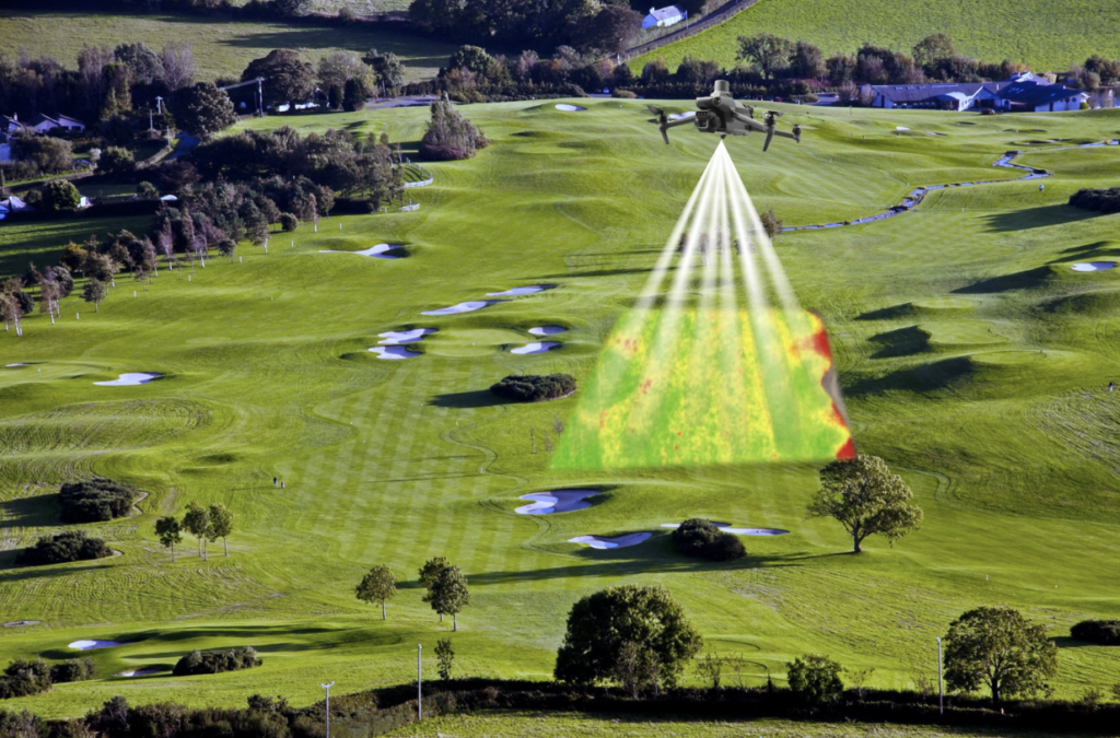
In precision golf course management, early fall is the most critical diagnostic window of the year — and golf course drone mapping is the tool that makes it actionable. As turfgrass prepares for winter dormancy, soil compaction, poor drainage, and microclimate water stress start taking a toll. Spotting these turf health changes before deep cold arrives can mean a smooth spring green-up and fewer costly repairs.
While traditional visual scouting only reveals damage after turfgrass shows visible harm, early fall drone scouting helps turf managers make informed decisions. To fully check your fairways and greens, you need synchronized data from multiple sources collected in a single flight:
- Synchronized thermal data
- Synchronized multispectral data
- Synchronized high-resolution RGB data
Whether you run an 18-hole course or a full resort, working with a drone expert like Tex-Air Drone is easy. Serving golf courses in Texas, New Mexico, and Oklahoma, Tex-Air Drone offers turnkey drone mapping and precision agriculture services. We also sell industry-leading Sentera Sensors, so superintendents can bring high-precision diagnostic mapping in-house.
Here is why diagnostic mapping with the Sentera 6X Thermal Pro sensor is the best starting point for your fall golf course management routine.
The Power of Single-Flight Data Synchronization
When mapping an 18-hole golf course from the air, using several passes with different cameras wastes time and creates data alignment errors. The Sentera 6X Thermal Pro solves this by combining six distinct optical channels into one lightweight, gimbal-stabilized payload:
- Four 3.2MP Global Shutter Multispectral Imagers: Green (550nm), Red (670nm), Red Edge (715nm), and Near-Infrared / NIR (840nm).
- One 20MP High-Resolution RGB Imager: Provides sub-centimeter visual context and elevation mapping.
- One FLIR Boson 640 Radiometric Thermal LWIR Imager: Measures long-wave infrared heat (8µm to 14µm) with 50mK thermal sensitivity.
Key Advantage: All six channels capture at the same time with built-in PPS sync. This lets the imagery layers overlay perfectly — vegetation health, thermal canopy temperature, elevation, and RGB visuals — allowing superintendents to compare thermal water stress against plant vigor in the exact same square inch of fairway.
Unlocking Early Fall Turf Diagnostics
1. Catching Water Stress 47 Hours Before Visual Symptoms
Thermal radiometric imagery measures canopy temperature, which directly reflects plant evapotranspiration. When turfgrass roots experience localized moisture stress or soil compaction, stomata close, causing leaf temperatures to rise. Paired with multispectral indices like NDVI and NDRE, reflectance data can flag drought and low moisture up to 47 hours before wilting or browning is visible to the naked eye.
2. Pre-Winter Drainage and Ice Encasement Risk Mapping
Winter-kill often strikes in areas where water accumulates and freezes into ice sheets. Research from the University of Minnesota WinterTurf Project shows that multispectral images and AI models work together to detect early signs of turf stress in poorly draining areas. Mapping these low areas with heavy moisture in early fall helps superintendents clear drainage lines, topdress, or adjust aerification before ice encasement destroys turf crown tissue.
3. Radiometric Accuracy Out of the Box
To make multi-date fall comparisons meaningful, data must be calibrated for changing sun angles and light conditions. The Sentera 6X Series pairs its sensor with an Incident Light Sensor (ILS) and a calibrated reflectance panel, ensuring radiometrically accurate, research-grade data on every flight.
High Efficiency for Course-Wide Coverage
Golf course drone mapping requires capturing large areas quickly without disturbing play. Slower drone sensors force pilots to reduce flight speeds to maintain image overlap, capping coverage.
With an industry-leading 5 FPS capture rate and a 512GB internal SSD, the Sentera 6X Thermal Pro lets drones like the DJI Matrice 400 fly at top speed while maintaining 75% or more overlap. A standard 30-minute flight can map dozens of acres at 1-inch multispectral Ground Sample Distance (GSD), making full-course diagnostic mapping fast and routine.
Integrating Drone Diagnostics into Your Fall Strategy
Once your early fall diagnostic flight is complete, the aligned data layers support targeted fall actions. These actions are supported by precision turfgrass management research published in peer-reviewed turf science literature:
- Spot Aerification & Soil Remediation: Use thermal hotspots to target compaction relief where irrigation penetration is failing.
- Prescription Herbicide Application: Use RGB, multispectral, and thermal images in GIS mapping software to spot-spray late-season broadleaf weeds — cutting chemical use by 20% to 60% versus blanket spraying.
- Variable-Rate Fall Nutrition: Map NDRE canopy chlorophyll levels to guide variable-rate nitrogen applications, strengthening desired turfgrass before dormancy while avoiding over-application that can encourage annual bluegrass (Poa annua).
The USGA Course Care program recommends integrated, data-driven fall turf management as a best practice for maintaining high-quality playing surfaces through winter.
Cost-Effective Fall Turf Program with Tex-Air Drone
Diagnostic mapping in early fall removes the guesswork from golf course maintenance costs. By using synchronized multispectral and thermal imaging, superintendents can protect their turf investment, use fewer chemicals, and support a strong, healthy spring green-up.
Tex-Air Drone offers full-service aerial mapping and custom equipment packages for superintendents who want to make informed fall turf care decisions. Our solutions support precision turf management across Texas, New Mexico, and Oklahoma. As an authorized dealer for Sentera Sensors, Tex-Air Drone provides the hardware, software, and local expertise needed to turn raw aerial data into actionable turf management decisions.
Check our service area to confirm we cover your course, then request a golf course mapping quote to schedule your early fall diagnostic flight before the window closes.
Frequently Asked Questions
How far in advance can thermal and multispectral drone sensors detect turf stress before it is visible?
Thermal radiometric and multispectral sensors can detect local water stress, compaction, and disease up to 47 hours before visual symptoms appear to the human eye — including wilting, browning, or turf dieback. By tracking canopy temperature and cellular reflectance (NDVI/NDRE), superintendents can intervene long before visual damage occurs.
Why is single-flight sensor synchronization important for golf course mapping?
Single-flight synchronization captures multispectral, high-resolution RGB, and radiometric thermal data at the same time, aligning each data layer to the exact same square inch. Capturing data in separate flights can cause alignment errors and shifts in atmospheric conditions. Synchronized multi-channel sensors like the Sentera 6X Thermal Pro prevent data offset and speed up flight coverage.
How does fall drone mapping reduce turf management chemical costs?
Fall drone imagery enables precision prescription maps that load directly into smart application equipment. By spot-spraying weeds and applying variable-rate nitrogen only where needed, golf courses can reduce chemical and fertilizer costs by 20% to 60%.
☎️ 806-318-1825 🌐 www.texairdrone.com